I-66/US 48 Corridor H
I-62/US 52 King Coal/TOLSIA Highway
I-68/WV 2 Corridor E
 |
.jpg)
Appalachian Development Highway SystemIn 1965, the Appalachian Regional Development Act called for the construction of 23 four-lane highways throughout Appalachia. Six of those corridors pass through West Virginia, and five of those have already been completed – Corridor D, which follows U.S. 50 from Cincinnati to I-79 in Bridgeport; Corridor E, which is now Interstate 68 from Morgantown to Hancock, Md.; Corridor G, which is U.S. 119 from Charleston to Pikeville, Ky.; Corridor L, which is U.S. 19 from Beckley to Sutton; and Corridor Q, which runs from Christiansburg, Va., to Pikeville, Ky., by following Routes 52, 19 and 480 through southern West Virginia. 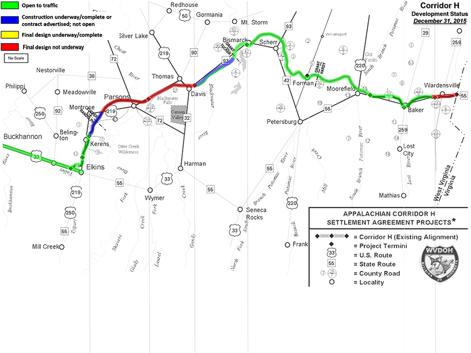
US 48 Corridor HCorridor H was initially intended to connect I-79 in Weston to I-81 near Strasburg, Va. Construction began in 1974 near Weston, and engineers had proposed two routes. The road would follow U.S. 33 to Seneca Rock and then either cross the Shenandoah Mountains to New Market, Va., or follow Route 55 to Moorefield and then into Virginia. Environmental and historical groups became concerned in the 1980's, saying the area around Shavers Fork needed protection from the construction and that the designers ignored the impact the highway could have on historical Civil War sites in Corricks Ford and Mooresville. A federal lawsuit was filed in 1995, but the U.S. District Court ruled in favor of the state. A second lawsuit was filed in 1998, but was dismissed a year later. 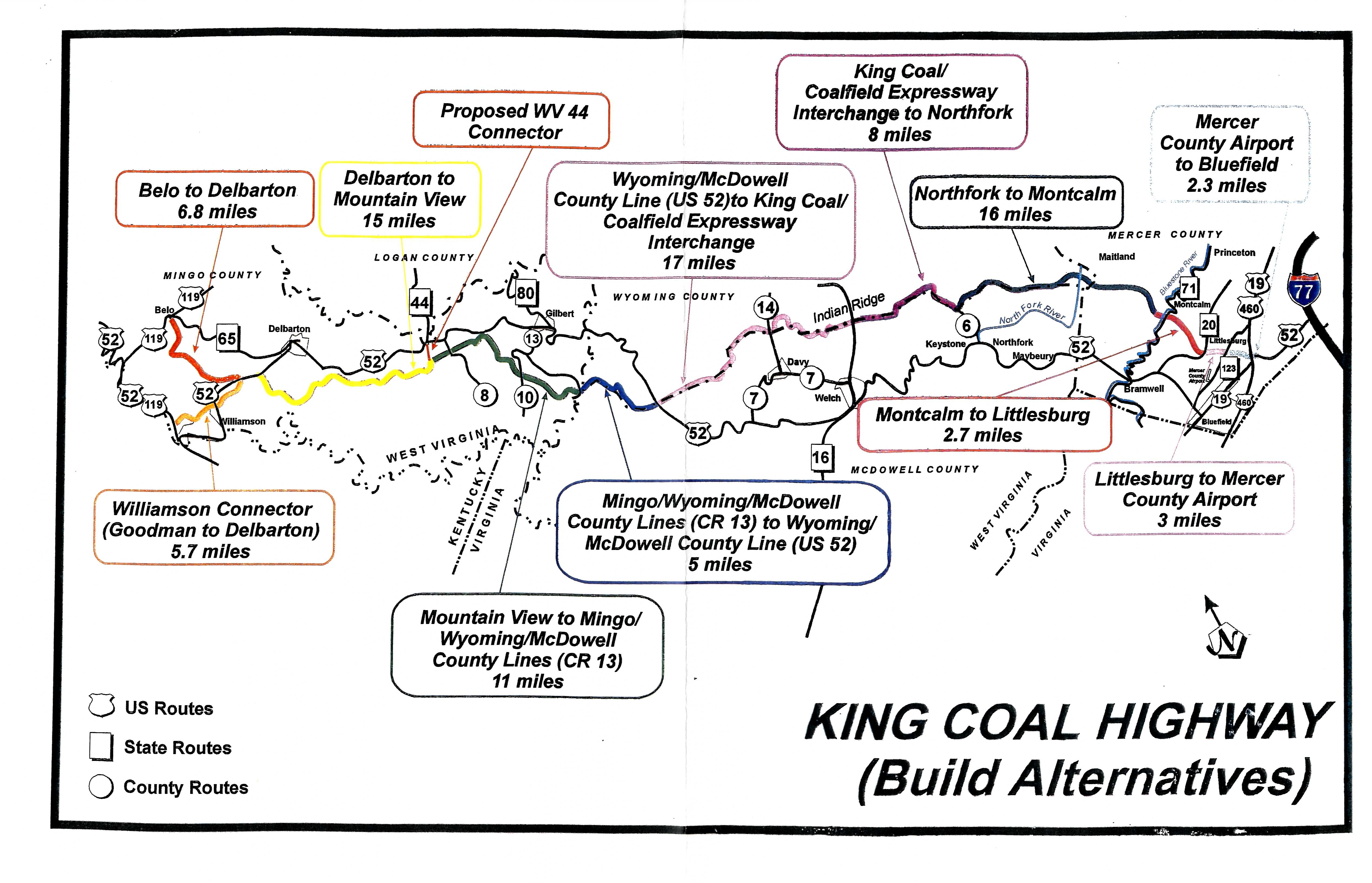
US 52 King Coal HighwayThe King Coal Highway Authority was established by the West Virginia Legislature in March of 1999 to promote and advance the construction of a four-lane divided highway that will become the new routing for US 52 through McDowell, Mercer, Mingo, Wyoming and Wayne counties replacing the existing US Route 52. The Authority coordinates with counties, municipalities, state and federal agencies, public nonprofit corporations, private corporations, associations, partnerships and individuals for the purpose of planning, assisting and establishing recreational, tourism, industrial, economic and community development of the King Coal Highway for the benefit of West Virginians. The West Virginia Division of Highways (WVDOH) plans to build the highway from a point near Williamson – at the intersection of WV 65 and US 119 – to Interstate 77 at its US 52 interchange in the Bluefield area (see map). After evaluating six alternative routes for the highway and considering public comments from a May 1998 public information workshop, WVDOH selected a Preferred Alternative. By the year 2020, engineers estimate the new highway would cut travel time on the existing US 52 to almost in half. The Preferred Alternative plan also includes a 4-lane connector, nearly five miles long, to improve access into Williamson. The connector would also provide access to the Mingo County Airport. The Preferred Alternative was chosen on the basis of its ability to meet the needs of the project while minimizing impact on the natural, physical and social environments. This selected route avoids the greatest number of archaeological resources and has the least impact on businesses and residences. This Preferred Alternative, however, remains "preliminary" until the completion of the entire public involvement process. The King Coal Highway will be a four-lane divided highway with partially controlled access between Williamson and Bluefield. It ultimately will cover approximately 90 miles of mountainous southern West Virginia, opening it up to faster, safer transportation. The route was designated as a High Priority Corridor in the National Highway System in the Intermodal Surface Transportation Efficiency Act of 1991. The corridor was actually designated as Future Interstate 73 and Interstate 74 Corridor and still is today. Since then, Michigan widthdrew its support for I-73 and Ohio widthdrew its support of both I-73 and I-74. North Carolina proceeded to build its sections of both I-73 and I-74 and South Carolina still plans to complete their part if funding exist. Virginia was supporting I-73 but its future is now a low priority, and since West Virginia based its support or I-73 on Virginia completing its section and Ohio on completing its part of I-74, the construction of I-73/I-74 using the King Coal and TOLSIA Highways is on indefinite hold. 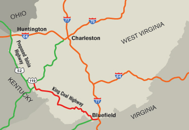
US 52 TOLSIA HighwayThe TOLSIA Highway is the portion of U.S. 52 in southern West Virginia that runs between Kenova in Wayne County and Williamson in Mingo County. The acronym is taken from the "Tug-Ohio-Levisa-Sandy Improvement Association", a group of local business people and community leaders who successfully lobbied in the 1950s and 1960s to have a new roadway constructed along the Big Sandy River. After the new road was built, the U.S. 52 designation which previously had applied to the road connecting Huntington and Crum was moved to the new road. The old road was renumbered as U.S. 152. State and federal officials pressed ahead with plans for upgrading it from a two-lane roadway to a four-lane divided highway. The new, upgraded road will be built in three sections, the first from Kenova to Fort Gay, the second from Fort Gay to Crum, and the third from Crum to Kermit. Construction on the upgrade, estimated to cost more than $800 million, began in 1996 and was expected to take a decade or longer to complete. |
|---|---|
|
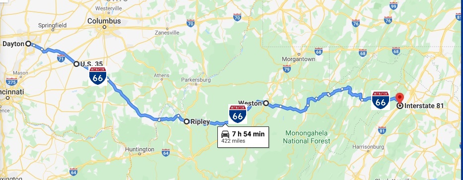
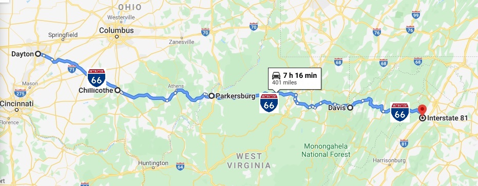
I-66 Ohio River Mound-Builders Historical CorridorUS 48 Corridor H would be converted to I-66. I-66 would continue to follow US 33 to US 35. US 35 would be converted to I-66 from the Ohio River to Dayton Ohio. I-66 would extend to I-70 west of Dayton. I-68 Ohio River Mound-Builders Historical CorridorI-68 Corridor E, which now runs from Morgantown WV to Hancock Md would be extended to the Ohio River. From there I-68 follows WV 2 to Parkersburg, then U.S. 50 Corridor D from Parkersburg to Athens, then OH 32 Corridor D to Cincinnati Ohio, terminating at the I-275/OH 32 interchange under re-construction as part of the OH 32 Eastern Corridor project. |
Virginia

 |
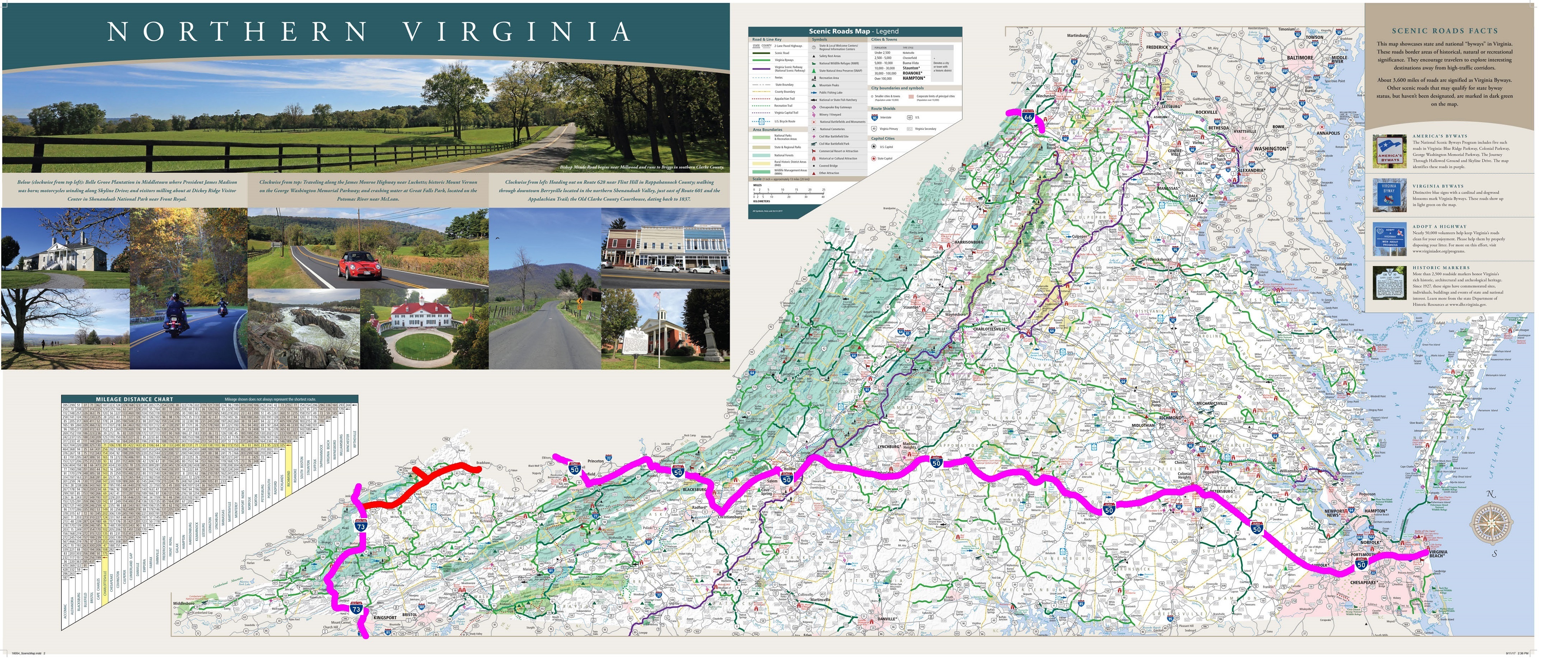
|
West Viginia


|
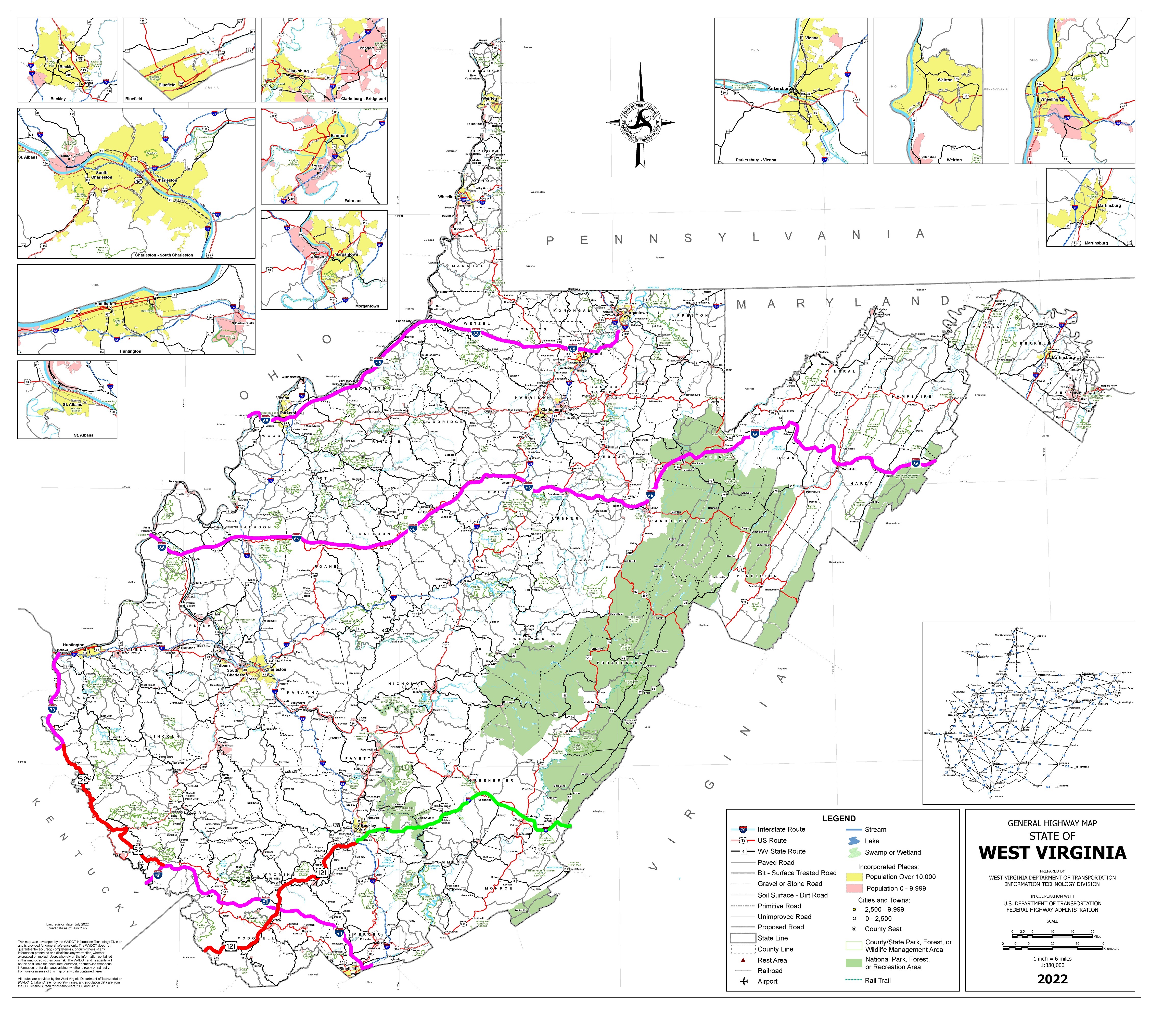
Corridor H was initially intended to connect I-79 in Weston to I-81 near Strasburg, Va. Construction began in 1974 near Weston, and engineers had proposed two routes. The road would follow U.S. 33 to Seneca Rock and then either cross the Shenandoah Mountains to New Market, Va., or follow Route 55 to Moorefield and then into Virginia. Economic studies indicated that the completion of Corridor H by 2020 in West Virginia by 2020 instead of 2035 or later could mean an impact of at least $1.25 billion from the building of potential manufacturing and distribution centers. A temporary secondary benefit is from the construction alone which could spur an additional $800 million in economic impact. The I-66 extension will have a strong secondary permanent benefit by make the scenic vistas of the Appalachian Mountain area in West Virginia even more accessible for tourism. |
Ohio
|
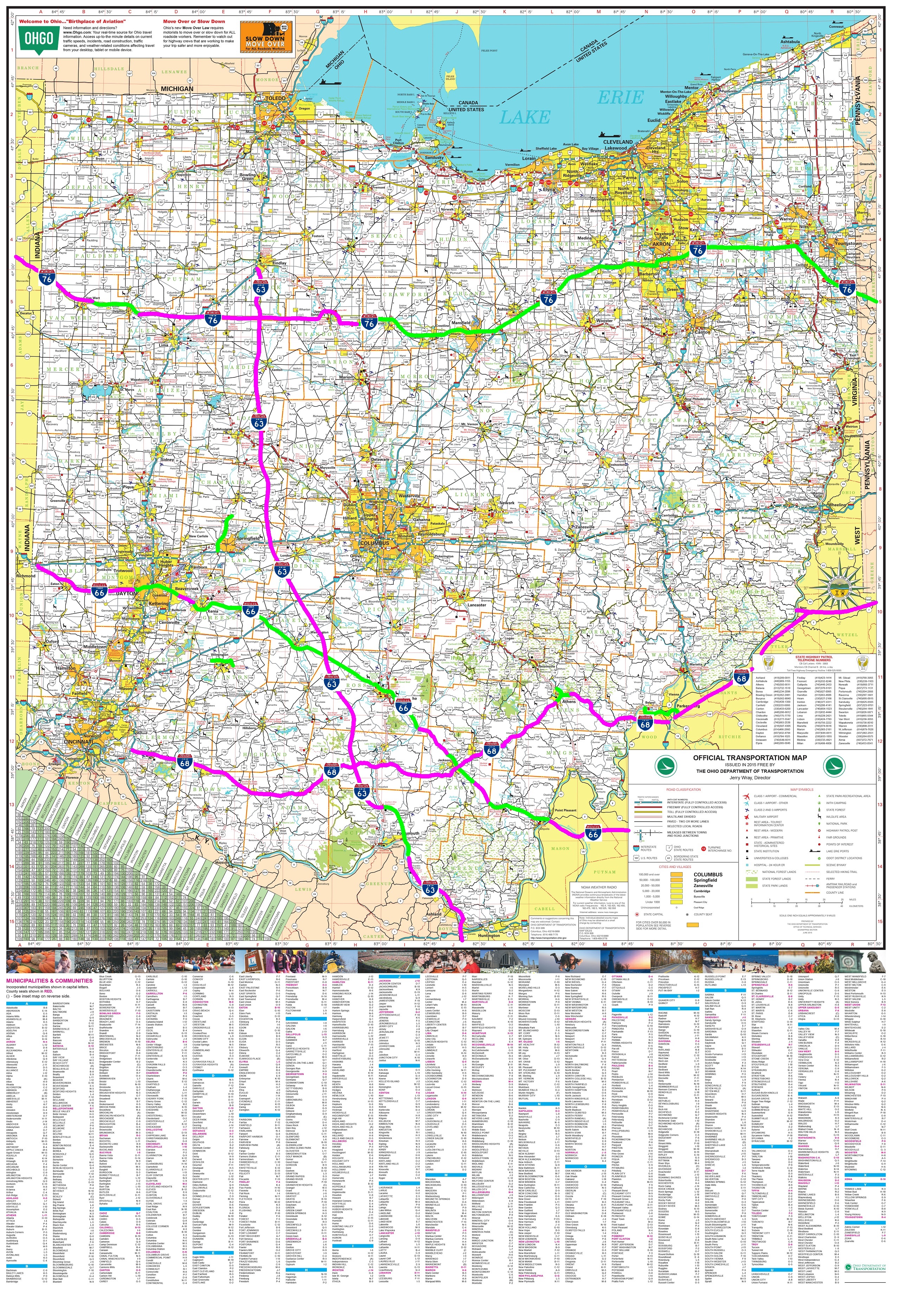
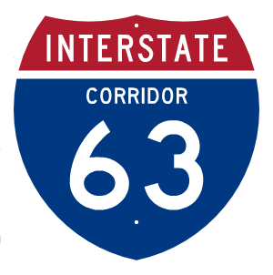
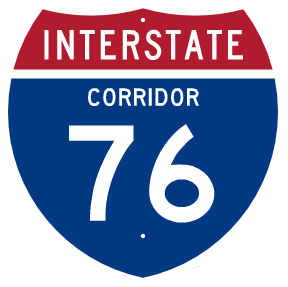
I-66 Ohio River Mound-Builders Historical CorridorI-66 uses the US 35 freeway through Ohio from the West Virginia border at the Ohio River to Dayton Ohio. The majority of US 35 is Interstate standard freeway with some sections east of Chillochthe four-lane divided highway that is slowly being upgraded by ODOT one interchange at a time to freeway standards. US 35 will need new interchanges in Beavercreek and will new freeway is required in west Dayton to extend I-66 to I-70 (also I-73 in this proposal). The Dayton Ohio area would particularly benefit from the more direct connection between the high concentration military and aerospace business near Wright-Patterson AFB in Dayton and in the Northern Virginia area. The extension of a freeway from I-75 to I-70 was part of the original Dayton Ohio freeway plans. The combination of extending I-66 through the west side of Dayton as well as potentially extending the existing Trotwood Connector north to I-70 with an interchange providing full east-west to I-70 will also improve the chances of economic development in socio-economically disadvantaged west area of Dayton and Trotwood. I-63 Emancipation Underground Railroad Historical CorridorI-63 departs from Corridor B following a new terrain route to US 68 east of Bellefontaine to I-75 then runs concurrent with Future I-76 using US 30 to Ft Wayne Indiana. I-76 West ExtensionI-76 is extended west first along US 30 across Ohio. I-68 West ExtensionI-68 extends west from West Virginia using US 50 then OH 32 to Cincinnati, terminating at the existing I-275 then east along the new OH 32 Eastern Corridor. I-68 connects to I-71 and I-75 via I-275. |
Future I-50/I-60/I-70 Transcontinental Pioneer Corridor
|
Future I-18 Acadian-Tejas Corridor, Future I-53 Mississippi River Mound Builders Corridor
|
|---|---|
Future I-66/I-68 Ohio River Mound Builders Historical Corridor
|
Future I-63 Emancipation Underground Railroad Historical Corridor
|
Future I-14 Gulf Coast Strategic Highway Corridor
|
Future I-76 Lincoln Highway Historical Corridor
|
Future I-49 Corridor
|
Future I-27 Ports to Plains Corridor, Future I-31 Great Plains Corridor, Future I-2
|
Future I-42 Conversion of U.S. 412 and U.S. 70
|
Future I-69
|



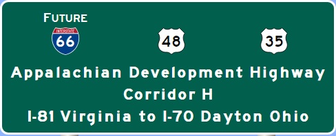 Future I-66 Alternative A: Southern Route via U.S. 33
